General News
17 October, 2024
Once in a generation mega hail storm smashes western Victoria
There was hail up to the size of a tennis ball in the storms.
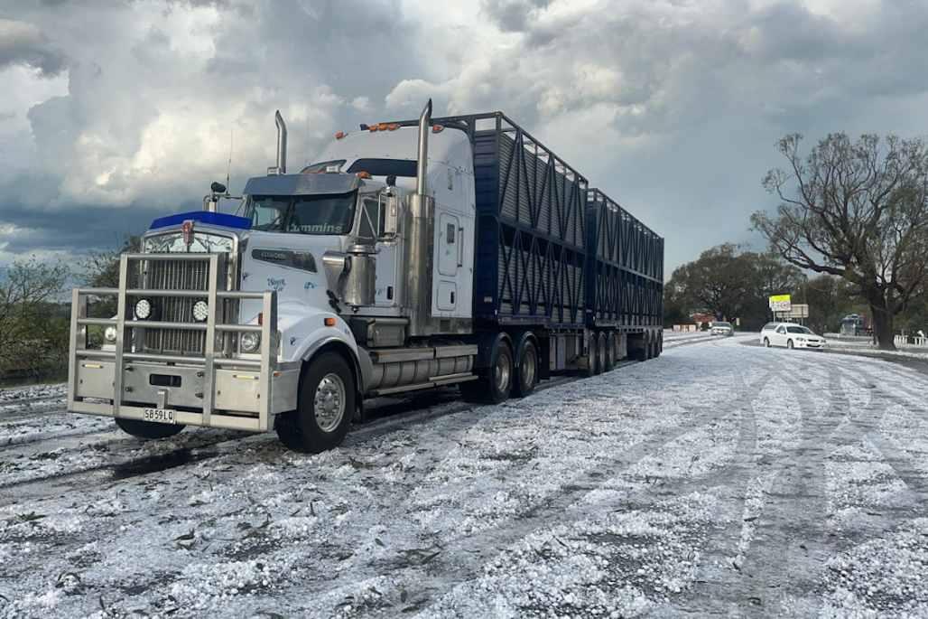
Western Victoria has been hit by a once in a generation series of storms with embedded giant hail as large as tennis balls in some instances.
Areas of severe damage were reported in centres through the Western District with Casterton particularly hard hit, while later in the evening the storms struck the southern Wimmera, with a storm front passing through south of Horsham to Murtoa, where hail damage was also reported.
There were reports of hail in excess of 5cm in diameter in both the Western District and Wimmera storms, with farmers in districts such as Wonwondah, south of Horsham and Green Lake reported hail sized in excess of golf balls, while in the urban centres of Casterton and Murtoa there were numerous reports of damage to property and vehicles.
"It has smashed up the patio and windows in both the house and the woolshed," said Wonwondah farmer Russell Heard.
"We are yet to assess the full damage to crops but it's going to be very substantial, the strip through my area was around 3km wide with some stones larger than 5cm, the biggest were around the size of a tennis ball."
"t has absolutely touched up the canola, the oats and the clover hay paddocks, while we need to have a closer look at the wheat to see how much it has been hit," Mr Heard said.
He said the storm hit yesterday evening, but there was still ice lying around the farm unmelted this morning.
"We had a shocking storm in 1992, but that is the only one I can think of that gets anywhere near it."
In terms of rainfall, very little was recorded in official Bureau of Meteorology (BOM) stations, with 22mm at Casterton the highest total, with 21mm recorded in half an hour, but there were private reports of much higher tallies, including 48mm at Dadswells Bridge, south-east of Horsham.
"We only measured 8mm but we're not sure that all the rain went in the gauge, due to the hail and the high wind, hopefully there is some moisture there that can help what crop is left," Mr Heard said.
Crop assessors will be busy over coming days surveying the damage.
It is not yet known how wide the bands of giant hail were.
"Through our area it seemed to be around 3km wide that saw the worst damage, in other districts that was a bit narrower, but then further out around Green Lake it could have spread out again, it was certainly a lot larger than you normally see with these sorts of storms," Mr Heard said.
The Wednesday evening system of storms comes just weeks after a similarly intense series of storms spread through Queensland's Western Downs region.
The BOM said giant hail could form when storm conditions were favourable.
This is when there is a thunderstorm with a strong updraught, which sees frozen raindrops, suspended in the updraught that then grow rapidly by 'sweeping up' small cloud droplets which freeze on contact.
Most hail in Australia is less than 25mm in diameter, meaning the hail stones at Casterton and Murtoa were markedly above average.
The storm risk has not abated, with the BOM issuing new warnings today for regions such as the Grampians and the Yarra Ranges.
"Southern and eastern Australia continues to see significant and widespread thunderstorms. This is being driven by a cold front crossing southern Australia, with a humid, unstable airmass in the east providing conditions conducive to storm development across broad areas," a BOM spokesperson said.